• Explore
    • Nature
    • Culture
    • Food
    • Family
    • Activity
    • Blog
  • Plan
    • Tourist info
    • Accommodation
  • For professionals
    • For professionals
    • Collaboration
    • News
    • Projects
    • Training
    • Repository
    • Community (opens in new tab)
    • Contacts
ENG
  • EnglishENG
  • EestiEST
  • LatviešuLAT
  • РусскийRUS
  • SuomiFIN
ENG
  • EnglishENG
  • EestiEST
  • LatviešuLAT
  • РусскийRUS
  • SuomiFIN
Popular searches:
Show all
  • Nature and Activities
  • Nature
  • Hiking Trails

Lõunalaagri hiking trail

Setomaa vald, Võru maakond, 64032

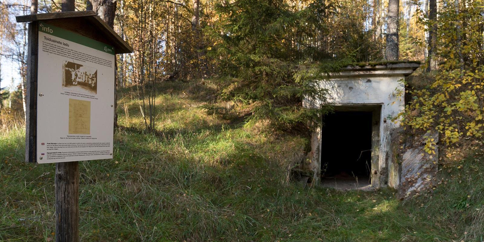
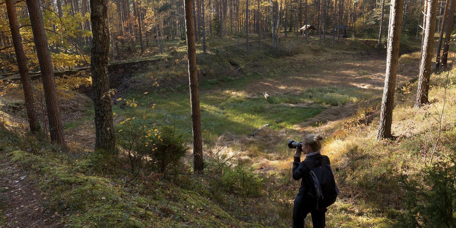
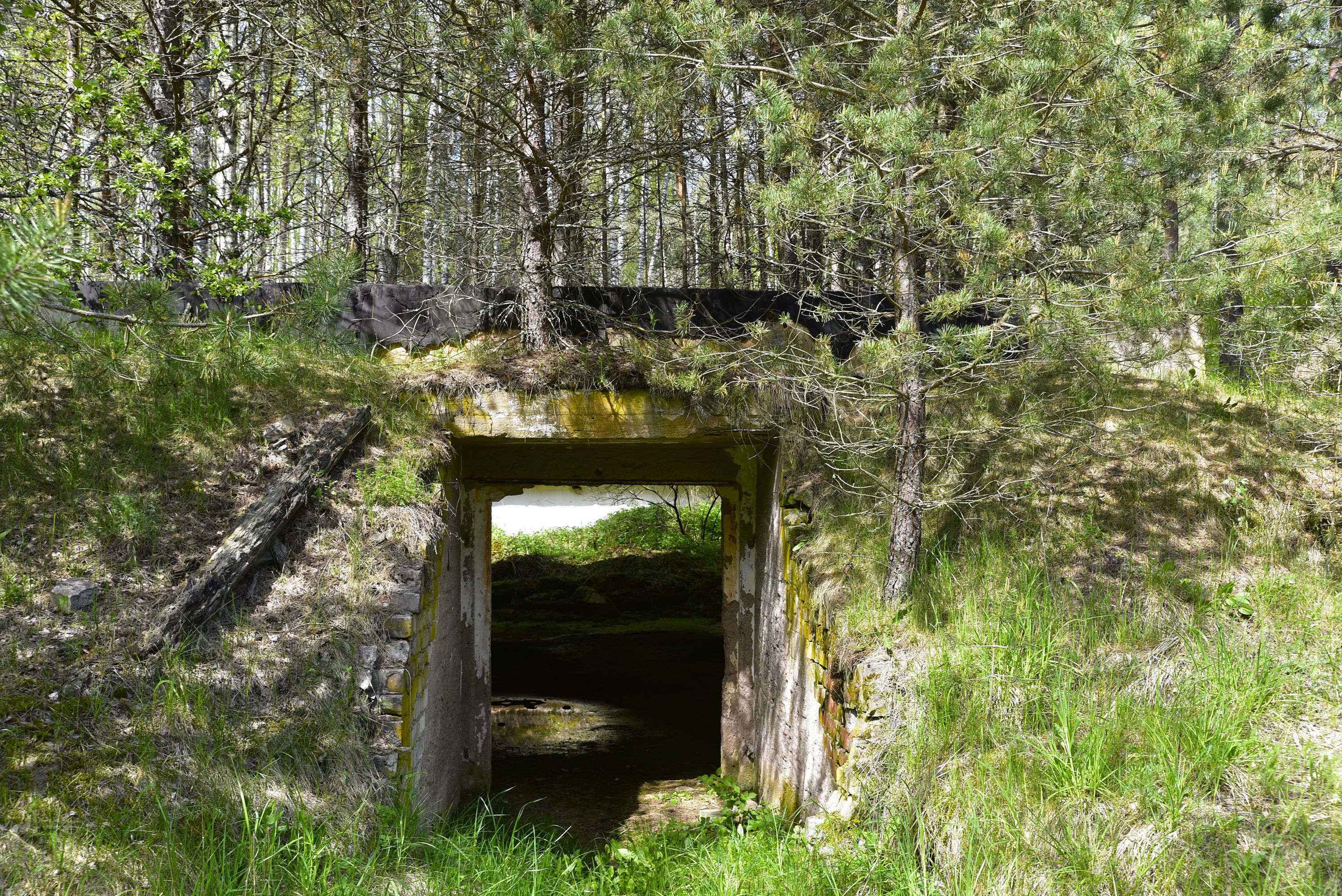
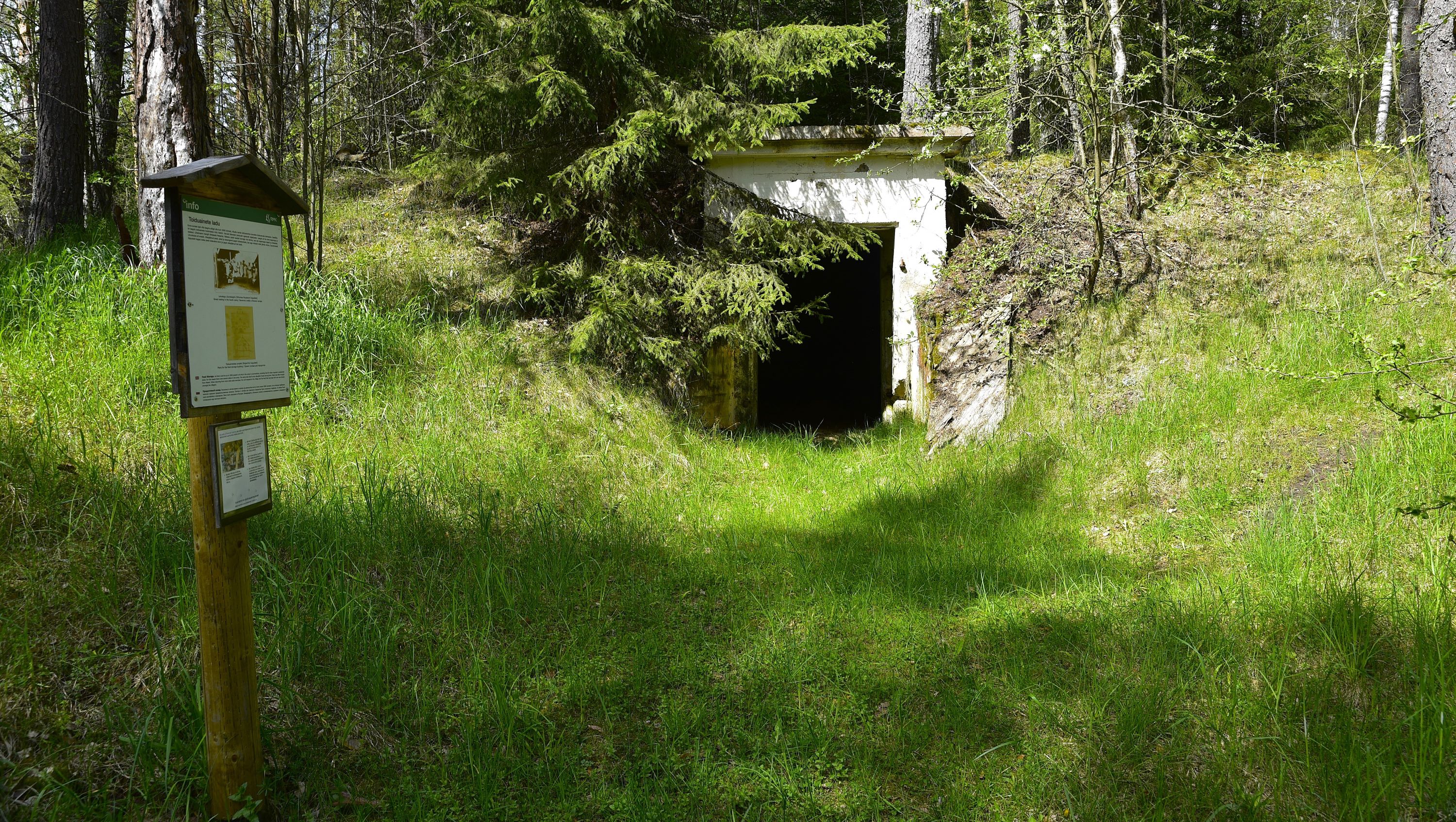
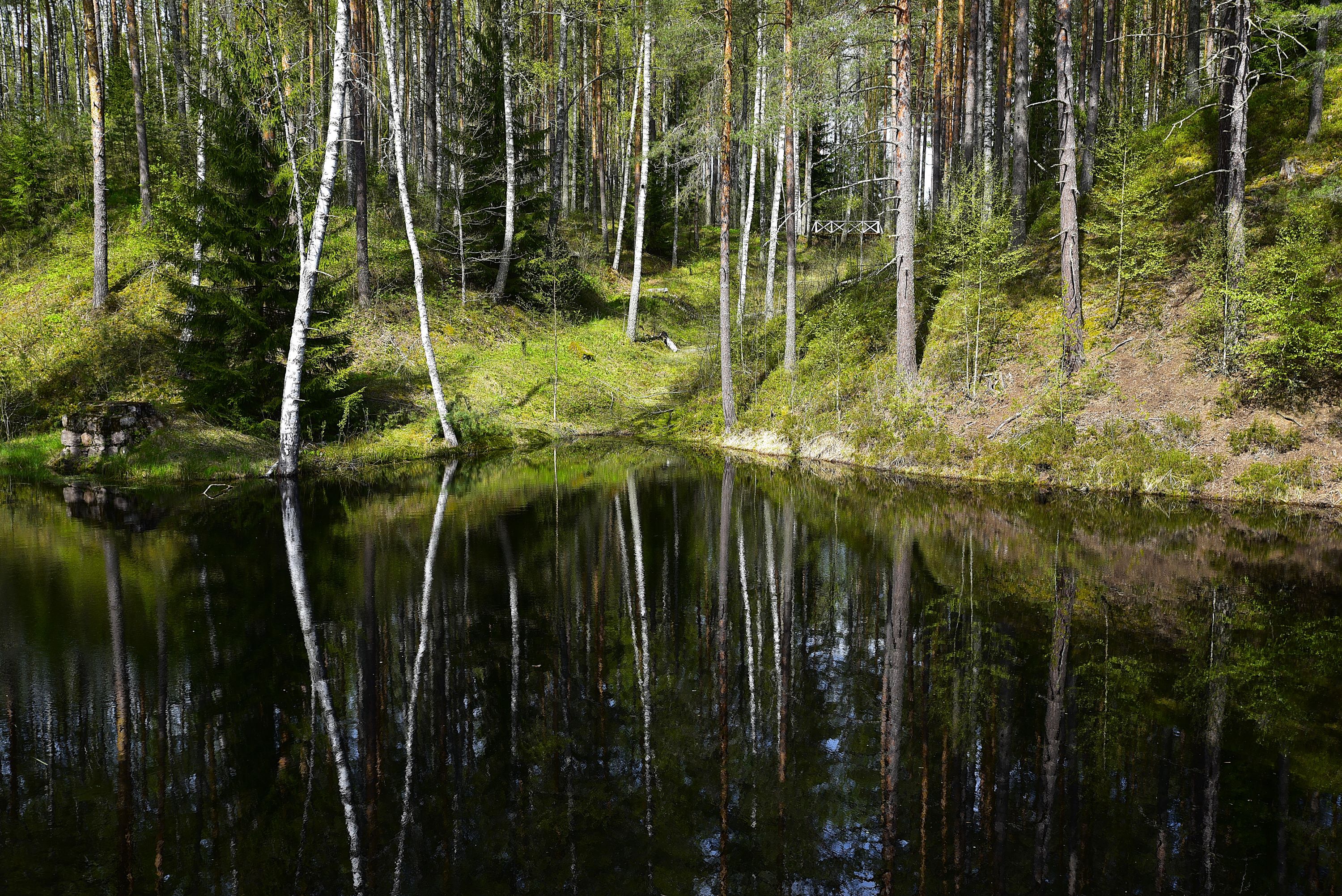
The 2 km long hiking trail of Lõunalaager is established on the former grounds of the Estonian Defence Forces’ Lõunalaager. In 1920, an impressive military complex was built here, where infantrymen practiced during the summer. Although nothing remains of the buildings, the shimmering reservoir among the trees, the old bridge, several foundation stones, and trenches speak of the realities of that time. Information boards provide additional reading about the past. It’s an experience to perceive how quickly nature hides everything once made by humans. The Lõunalaager hiking trail offers a unique opportunity to combine a light nature walk with the heritage of Estonia’s military history.
The natural course of the trail around the reservoir and over the old bridge creates a peaceful, almost meditative atmosphere. The RMK campfire site allows for a rest break and, if necessary, camping.
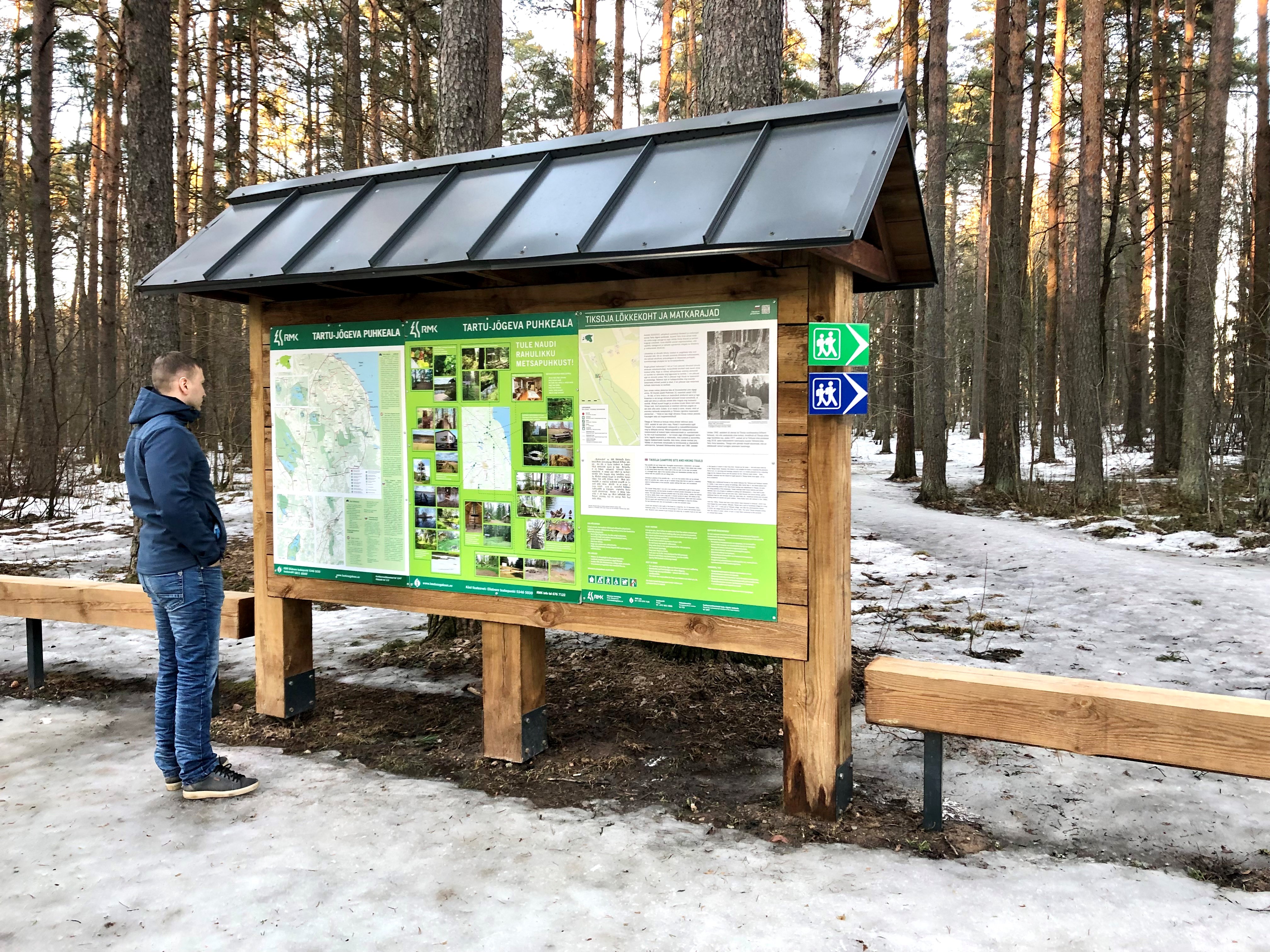
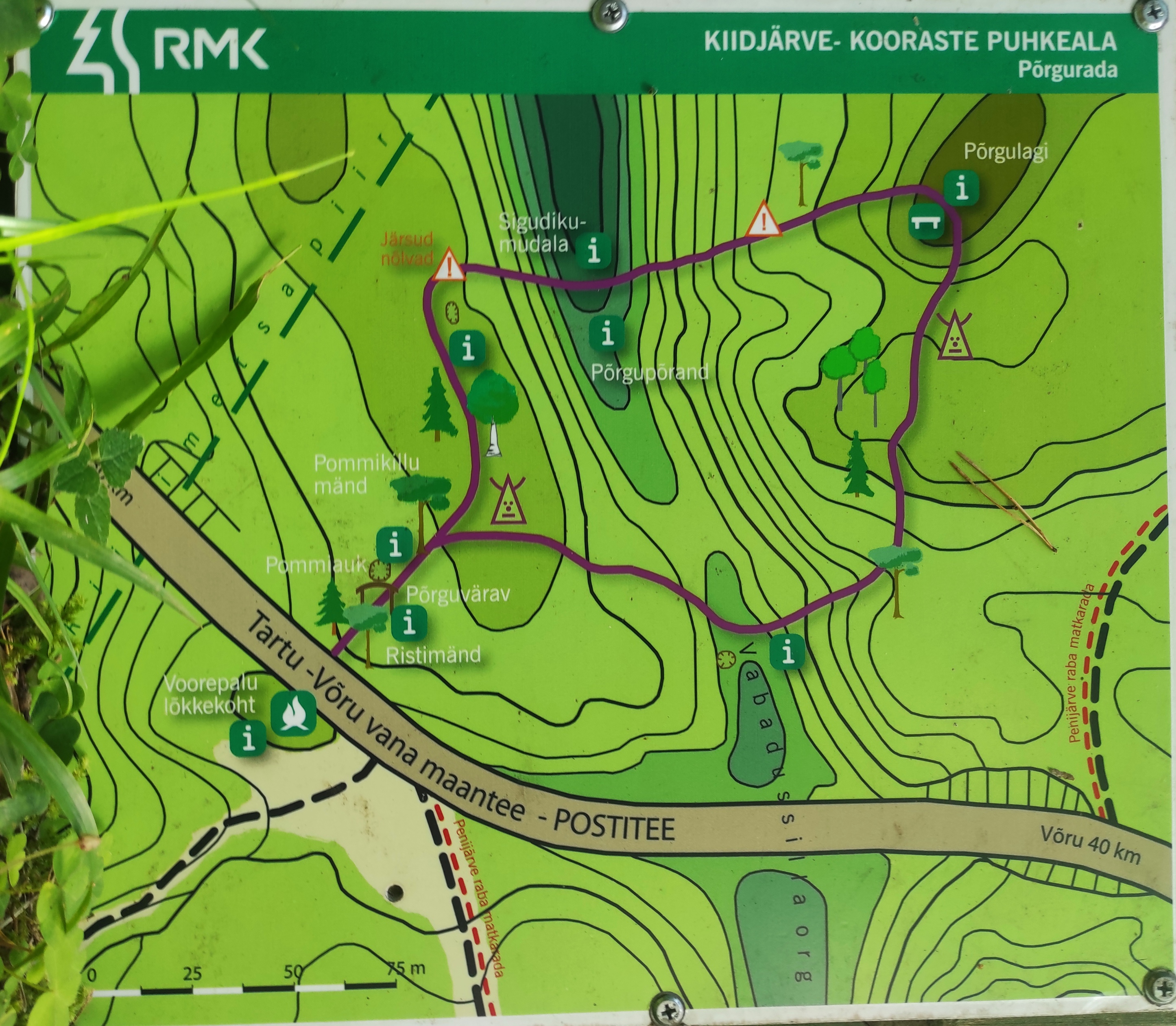
The trail is marked, and information boards help understand the area’s significance in the history of the Estonian Defence Forces. Crossing with the shooting range cycling trail offers an additional opportunity for longer movement – thus, a more sporty day loop can be initiated from Lõunalaager.

Amenities

  • Information boards
  • Drop Toilet
  • Free parking

Open times

Throughout the Year

Around the Clock

Contact

  • +372 676 7122

Links

loodusegakoos.ee

See more

  • Camping sites
  • Hiking Trails

Piusa River valley hiking trail

The total length of the hiking trail in the primeval valley of the Piusa River is 15 km from the ruins of the Vastseliina Episcopal Castle to Lindora or vice versa. You can take the trail on foot, but parts of it are also passable either by bike or car. The highlights of the reserve are the tall Devonian sandstone outcrops – the tallest of them is the wall of Härma Mäemine or the Keldre Wall (total height 43 m, length 150 m). There are two camping sites – under the Make Wall on the first third of the trail and under the Härma Lower Wall towards the end of the trail.The object is not lighted, which is why we recommend to visit it during the day.

  • Hiking Trails

Tiksoja hiking trails and campfire sites

The Tiksoja hiking trails located near Tartu are suitable for families, amateur athletes and dog owners. The 1-2km circle-shaped trails start from the Tiksoja campfire site parking lot. The versatile trails run along forest paths. The 700-meter trail with compacted gravel cover you will be able to walk with a baby carriage or wheelchair. The 1-kilometre trail features activity areas for children and a fenceless area for dogs, the 2-kilometer trail features an outdoor gym. The trails are characterised by various bridges and crossings, a boardwalk and information boards located at interest points.You can rest at the Tiksoja campfire site with two roofed bench-tables and campfires with grilling griddles.

  • Hiking Trails

Hinni canyon

Hinni Canyon is located in the special protection zone of Haanja Nature Park and is a unique canyon valley in all of Estonia. Hinni Canyon has cut into Devonian era sandstone. It is a 15-20 m deep and 300 m long ravine with steep slopes, at the bottom of which flows the fast-flowing Enni stream. When visiting Hinni Canyon, it is worth considering that here you can experience the true power of nature: the sandstone cuts through the landscape, deep in a transverse direction, the slopes rise around – this is a rare and visually impactful place in Estonia. The trail at the bottom of the valley runs alongside the stream. Enni stream flows quickly and adds the sound of water and fresh air to the adventure. Moreover, in the outcrops, you can notice indentations, smaller caves, and more secluded inner cuts, creating a mystical feeling. From a nature conservation standpoint, it is important that this place is located in the special protection zone.Good to know: there is no additional lighting at the site, so it is best visited during the day. Since Hinni Canyon is partially located on private land, walking with dogs is not allowed!

  • Hiking Trails

Pullijärve hiking trail

Located next to the community of Misso, Pullijärv is a nice place to spend some time. If you don't feel like swimming, you can hike around the lake: the 3.6-kilometer-long trail is just the right length for the whole family. The trail rises here and there too: boys used to do ski jumps from its highest point onto the lake in winter.The trail begins and ends at the RMK Pullijärv rental hut, which is located on the north shore of the lake. In spring and fall, the trail can be really wet.

  • Hiking Trails

RMK Voorepalu Põrgurada trail

The hiking trail, which is suitable for a pleasant walk, starts on the other side of the road opposite the Voorepalu campfire site and runs along an extremely varied landscape with several steep ascents and descents. The trail has information boards introducing past events and folklore and the highest point of the trail has a table and benches for resting. Rope railings have been installed on the steep slopes of the trail.The historical Postal Road runs between the campfire site and the hiking trail. Ristimänd tree and many other exciting places are on the trail with a varied landscape. Two cars can park at the campfire site.

  • Hiking Trails

Padakõrve Hiking Trail

The hiking trail runs along a gravel road in a forest and introduces the life of ants. There are information boards next to the gravel road, as well as signposts near the ant colonies. The trail can also be explored in a vehicle. The 3.6 km trail starts at the information board at the roadside.The hiking trail is located in Padakõrve Nature Reserve. Its most important values include one of the largest populations of Scottish wood ants, diverse forest communities, and a multifaceted landscape. The purpose of the protected area is to protect the Scottish wood ants, as well as other protected species and their habitats, the forest communities, and the Kärgandi kame field.

  • Family friendly
  • Lookout towers
  • Hiking Trails

Ööbikuorg valley and Rõuge lakes

The Rõuge primeval valley, which is 10km long and 52m deep, contains seven lakes: Kahrila Lake, Tõugjärv, Ratasjärv, Kaussjärv, Rõuge Suurjärv, Liinjärv, and Valgjärv. The lakes are connected by the Rõuge or Ajo River, which starts from the Tindi valley. The side valleys of the Rõuge primeval valley are Tindi, Külm, Mõhk, Ööbikuorg, Tinopeetri, Hinni, Sikasoo, and Järveotsa valleys. The most famous of these is Ööbikuorg, which borders the ancient hillfort from the north. In spring, during the blossoming of bird cherry trees, the valley resonates with the song of nightingales – hence the name of the valley. Several hiking trails run through Rõuge, including the popular Ööbikuorg hiking trail, which takes visitors through the primeval valley, past lakes and springs. The trail is suitable for families with children and is partially accessible by bicycle. In summer, you can swim and paddle in the lakes, while in winter, the same trails are enjoyed by skiers and sledders. In the Rõuge settlement, there is also Estonia's deepest lake – Rõuge Suurjärv (38m) – and the largest Nature Clock in Estonia, whose hands mark the passage of time in nature's rhythm.Good to know: At the edge of Ööbikuorg, there is a visitor center and the Pesapuu observation tower, which offers a view of the entire valley.

  • Hiking Trails
  • Parks
  • Beaches

Lake Pühajärv

Pühajärv, with its picturesque winding shoreline and four islands, is the largest lake in Otepää Nature Park. At the northern tip of Pühajärv, there is a beach area with a beach house, ball courts, a children's playground, recreation areas, a café, and a boat harbor. At the southern tip is the Kooliranna recreation area, and from there begins the Väike Emajõgi, which meanders through Valgamaa. Pühajärve Park is the starting point for the Murrumetsa hiking trail, and around the lake runs the 12 km long Pühajärve hiking trail, which passes by the lake's most famous spring, the Armuallikas. In winter, when weather conditions are suitable, an ice trail is created on the lake for hiking, and a winter swimming area is open at Pühajärve Beach.Pühajärv has provided plenty of inspiration for writers and artists. For example, Fridebert Tuglas and Eino Leino have vacationed here. Information about Konrad Mägi's Pühajärv paintings can be found on an info board by the lakeshore near the GMP Pühajärve restaurant. In 1991, the Dalai Lama, Tenzin Gyatso, visited Otepää and blessed the lake, an event commemorated by a wooden sculpture on the shore of Pühajärve Park.

  • Collaboration
  • News
  • Contacts
  • Privacy Policy
Join our mailing list!

"*" indicates required fields

This field is for validation purposes and should be left unchanged.
I authorise marketing

Southern Estonian Tourism Cluster

info@visitsouthestonia.com