• Explore
    • Nature
    • Culture
    • Food
    • Family
    • Activity
    • Blog
  • Plan
    • Tourist info
    • Accommodation
  • For professionals
    • For professionals
    • Collaboration
    • News
    • Projects
    • Training
    • Repository
    • Community (opens in new tab)
    • Contacts
ENG
  • EnglishENG
  • EestiEST
  • LatviešuLAT
  • РусскийRUS
  • SuomiFIN
ENG
  • EnglishENG
  • EestiEST
  • LatviešuLAT
  • РусскийRUS
  • SuomiFIN
Popular searches:
Show all
  • Nature and Activities
  • Nature
  • Hiking Trails

Õrsava Lake Hiking Trail

Silla tn 6/1, Setomaa vald, Võru maakond, 64001

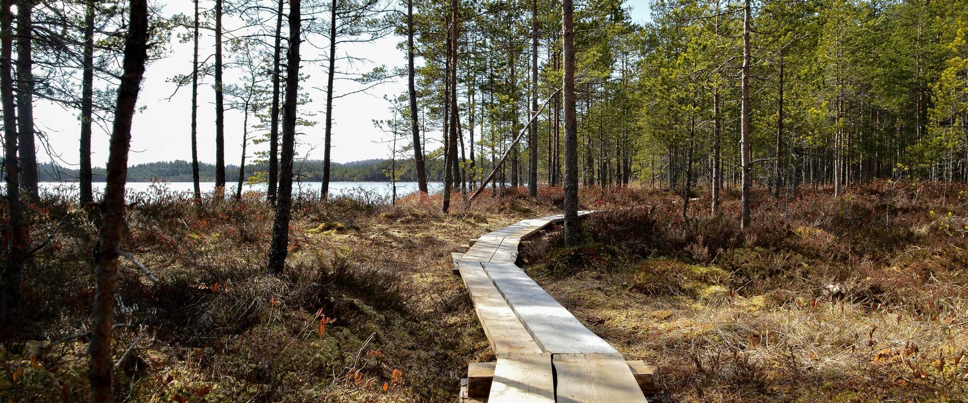
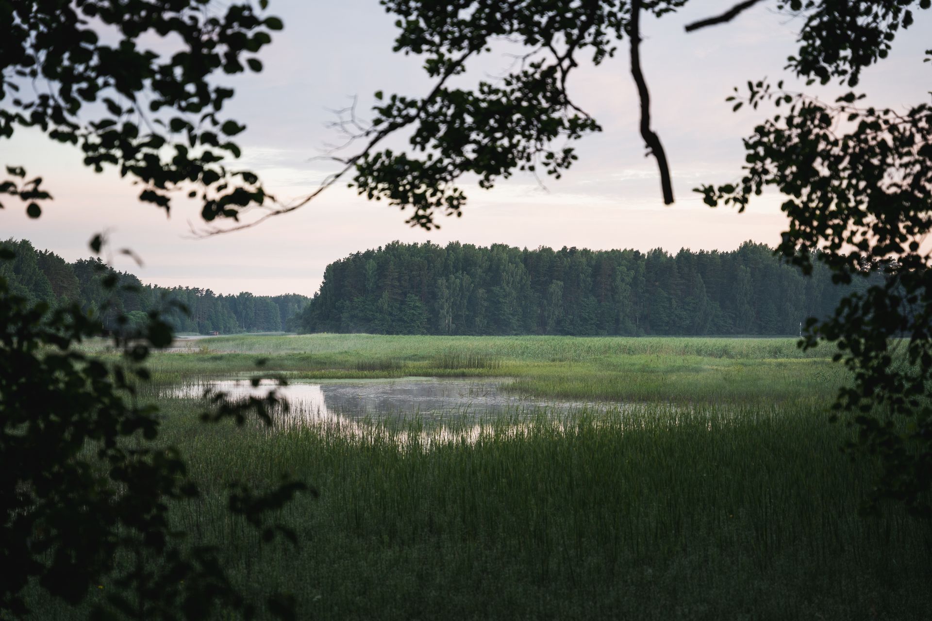
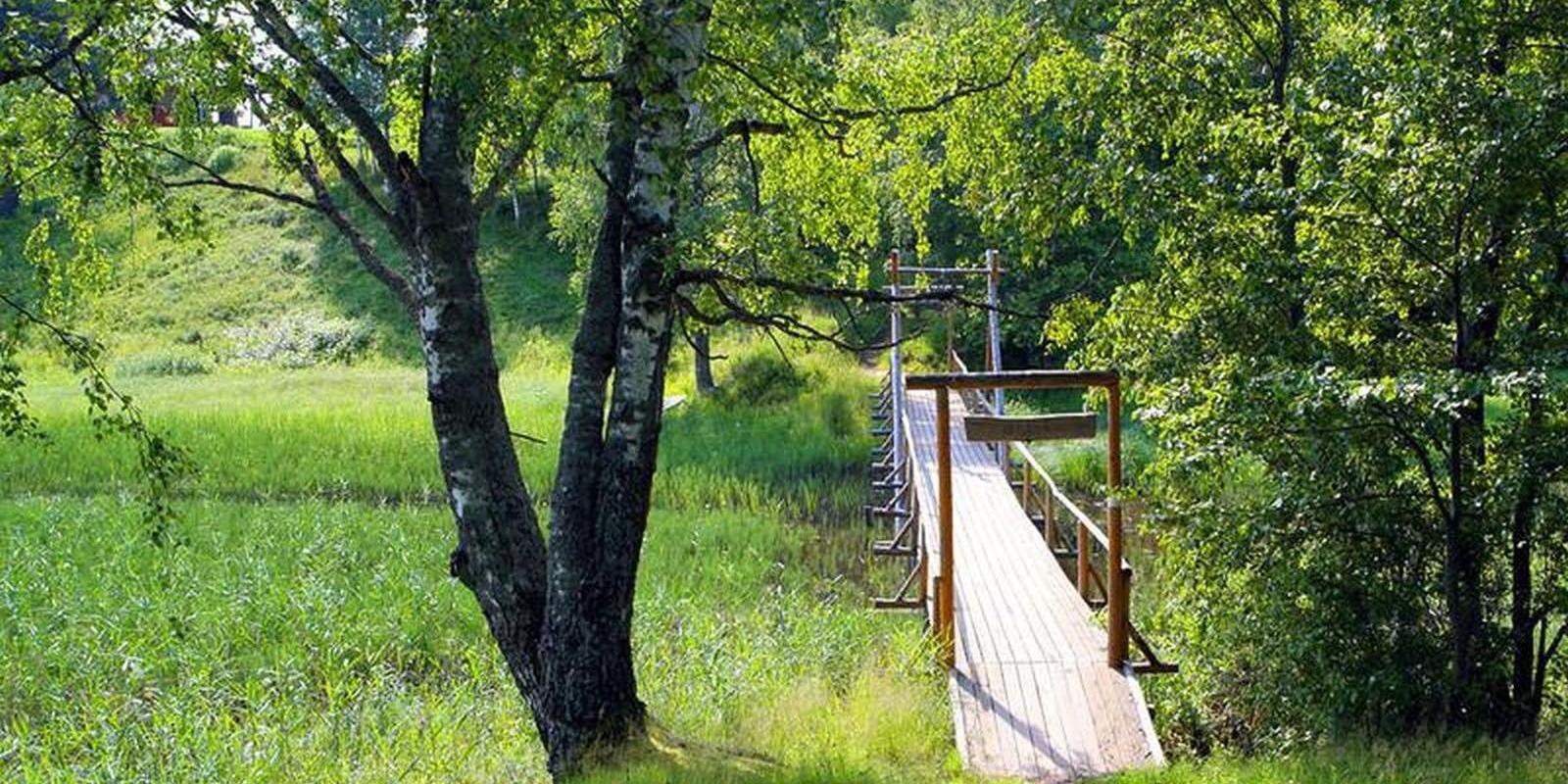
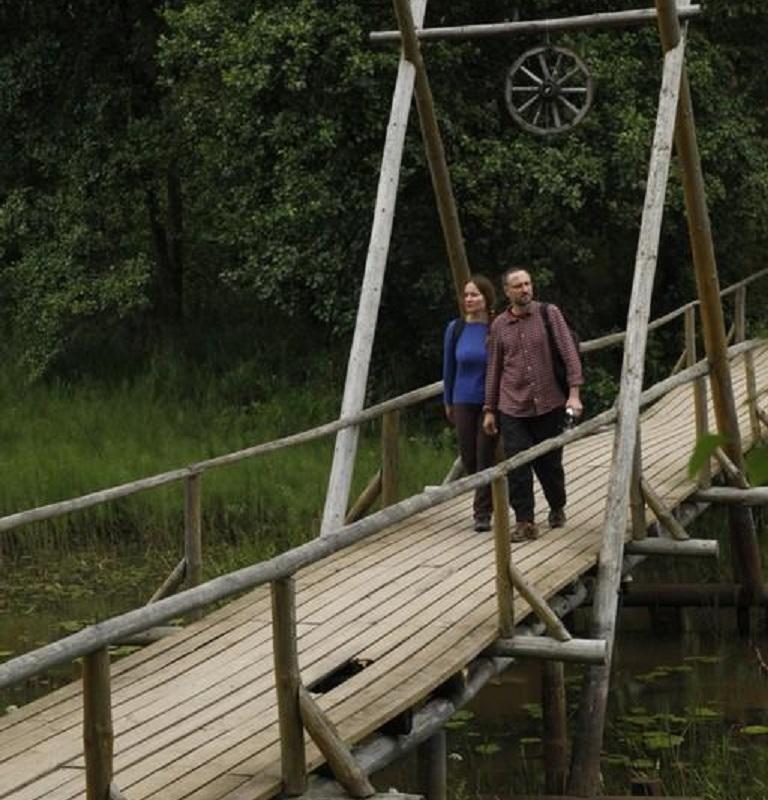
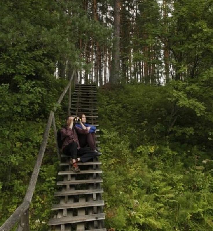
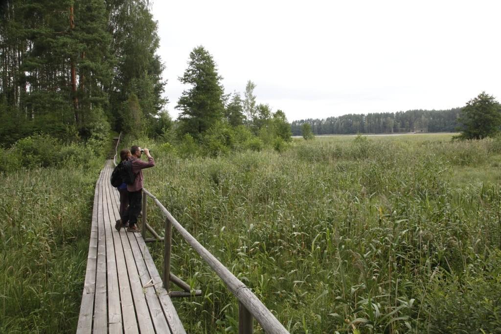
The Õrsava Lake Hiking Trail winds around the lake of the same name. The 5 km trail starts officially at the Värska school stadium, but you can start at any point. The lakeside footpath is made more exciting by several bridges. On the shore of Õrsava village there is a campfire site and an RMK bonfire site, as well as a swimming area.In addition to scenic views of nature and pine forests, the hiking trail offers some history: it’s partly on the road of the former Estonian Defense Forces Training Center, the so-called , and although the camp was largely dismantled in World War II, some soldiers’ barracks and other buildings have been preserved.

Amenities

  • Information boards
  • Drop Toilet

Open times

1. jaan - 31. dets

Around the Clock

Contact

  • +372 5682 1268
  • turism@setomaa.ee

Links

matkajuht.ee

See more

  • Camping sites
  • Lookout towers
  • Hiking Trails

Tellingumäe observation tower and recreational area

Tellingumäe's 25-meter-high observation tower offers a beautiful view of the winding Mustjõgi gorges and the hilly landscape typical of South Estonia. Latvia can be seen in the distance, as nearby the Mustjõe River joins the Koiva (Gauja) River on the Estonian-Latvian border. Tellingumäe observation tower is a great place to observe nature and birds. Several rare bird species can be found here. The tower has an RMK campfire site and marked cycling and hiking trails of different lengths, like the Estonian-Latvian joint cultural heritage trail and the Koiva Cycling Trail.

  • Camping sites
  • Family friendly
  • Hiking Trails

Fairy Trail

The Fairy Trail, also known as the Vitipalu Adventure Trail, offers a fairytale experience for both children and adults. The trail takes you through the mushroom and berry forests of Elva, where Witch Island awaits, featuring the lovely "Little Witch" house, cool tree sculptures, and a low-adventure trail built in the middle of the forest, perfect for children and families to have a great time in nature. The 1.4 km long trail, part of which is accessible with a stroller, intersects with the Elva River's primeval valley hiking trail and introduces the diverse landscape of Elva. The trail starts and ends at the RMK Jõeharu picnic area and camping site, where several shelters with grills and campfire sites are available.

  • Hiking Trails

Lake Viti hiking trail and observation tower

The Lake Viti hiking trail is a nature trail that passes through an exciting hilly forest landscape. The trail information boards provide information about the Vitipalu forests, the woodpeckers that inhabit them, their nesting sites, the ant kingdom, and more. The trail features a hiking hut, a campfire site, Viti Lake, a 20-meter-high wooden observation tower overlooking the surrounding greenery, and a pleasant picnic spot with shelters. The Lake Viti trail is suitable for hikers of all ages, but it is not suitable for strollers or wheelchairs. The Lake Viti hiking trail begins and ends at the trail parking lot. The trail is marked with yellow stripes.

  • Hiking Trails
  • Guided tours

Kiidjärve Visitor Centre

Kiidjärve Nature Centre is located in Kiidjärve-Kooraste recreation area on the banks of the picturesque Ahja River in Kiidjärve village. It seeks to guide visitors, young and old alike, to the beautiful scenery of the area so that the forest and nature itself will reveal their secrets to a keen observer. The nature centre has information materials and information about Kiidjärve-Kooraste, other RMK recreation areas, and other various attractions. In the immediate vicinity are famous celestial Taevaskoda sandstone outcrops, Kiidjärve Formica kingdom, and the picturesque Valgesoo bog.

  • Hiking Trails

Hiking trails at Lake Kirikumäe

Kirikumäe's 3.2-km-long hiking trail winds around the lake of the same name, which is known as the best swimming area in the region. There is a bog on the southern shore of the lake and the hiking trail also runs across the bog. For this purpose, a boardwalk has been built there. In any case, however, you must be prepared to get your feet wet here and there. There are information boards, campfires, and forest trails on the track.

  • Hiking Trails

Taagepera hiking trail

The total length of Taagepera hiking trail is 5.4 km. The trail begins and ends at the Taagepera campfire site and partly runs along the shores of the Õhne River. The trail can also be completed in smaller circles – 1.6 km and 4.0 km long. There are wooden signposts and information boards at the hiking trail, capfire site is suitable also for camping.The main sights of the hiking trail include the Taagepera Castle with the Castle Park, Taagepera Church and the Cemetery, the graveyard of barons, the Musukivi rock, the sacrificial stone, the underground cemetery, and the Õhne River.A truly inspiring hike full of history, architecture, and ancient nature!

  • Hiking Trails

Wood Ants’ Trail of Kiidjärve

Among the approximately 1 km study trail introducing the life of wood ants, the hiker can feel like a giant in the minuscule world of ants. In an area of 20 hectares there are 200 ant hills, the biggest of which is 1.7 m high; you can also admire the record-high spruce (42 m). The trail has signs, information boards, and bridges crossing ant highways.The trail is for walking only. While hiking on the trail near ant hills, use only the bridges installed there. The Laari forest study trail starts on the other side of the railway.The civilisation of ants offers an experience for both children and adults.

  • Hiking Trails

Hiking trail Green Railways Valga / Valka–Ape

The Valga/Valka–Ape narrow gauge railway was opened to traffic in 1900 and the last trains ran here in 1970.Today, most of the old railway embankment is used as a hiking trail that runs through forests and fields on gravel and dirt roads.On the Valka–Žuldin and Koikküla–Hargla section, the trail is redirected to larger roads, because the former railway dam is mostly impassable there.Many old railway photographs and historical stories related to the railway have been attached to the old sleepers on the railway dam.There is a resting place in Hargla.

  • Collaboration
  • News
  • Contacts
  • Privacy Policy
Join our mailing list!

"*" indicates required fields

This field is for validation purposes and should be left unchanged.
I authorise marketing

Southern Estonian Tourism Cluster

info@visitsouthestonia.com