• Avasta
    • Еда
    • Природа
    • Культура
    • Семья
    • Спорт
    • Сообщество
    • Блог
  • Planeeri
    • Размещение
    • Информация
    • Varamu
RUS
  • РусскийRUS
  • EestiEST
  • EnglishENG
  • LatviešuLAT
  • SuomiFIN
RUS
  • РусскийRUS
  • EestiEST
  • EnglishENG
  • LatviešuLAT
  • SuomiFIN
Populaarsed otsingud:
Näita kõiki tulemusi
  • Nature and Activities
  • Nature
  • Hiking Trails

Taagepera hiking trail

Tõrva vald, Valga maakond, 68504

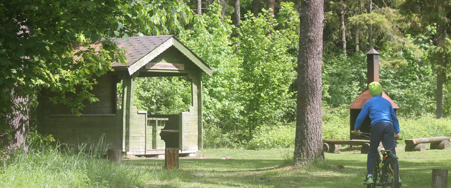
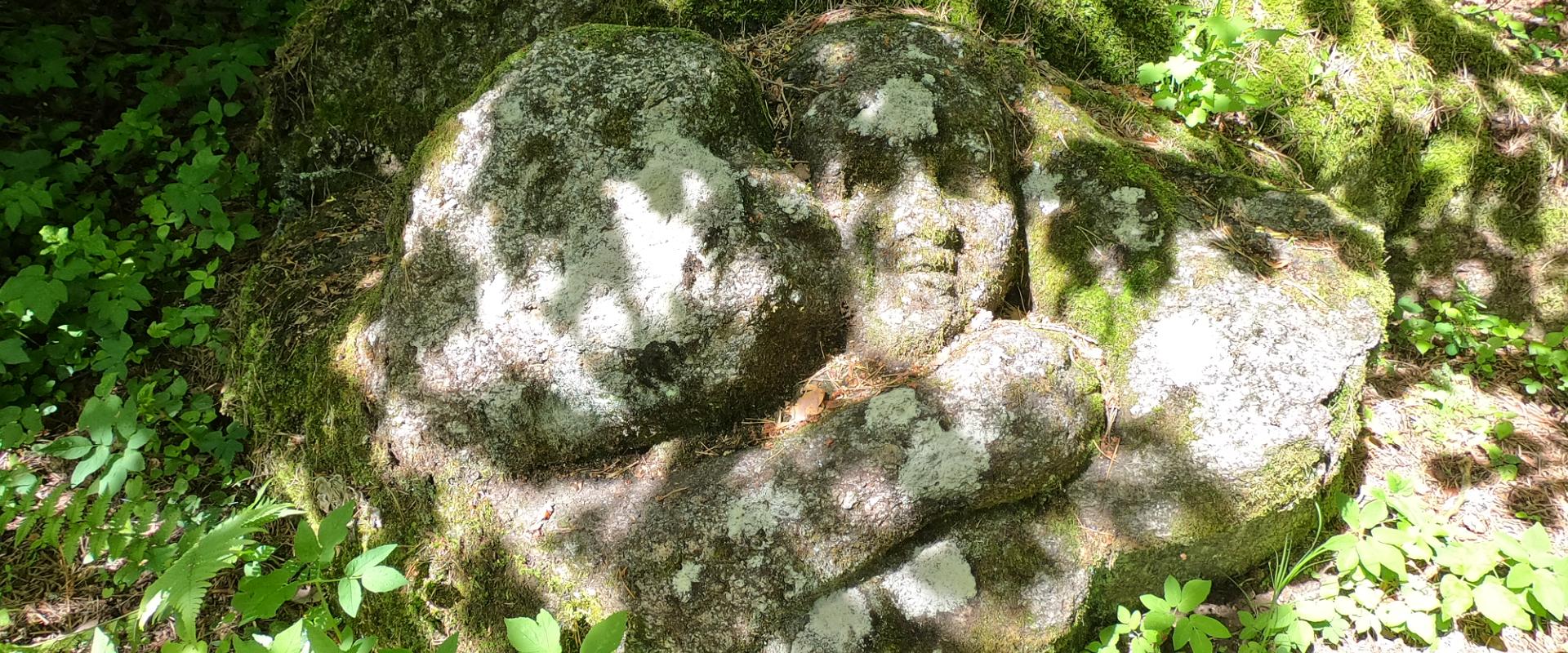
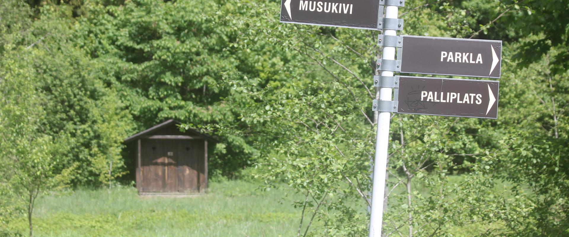
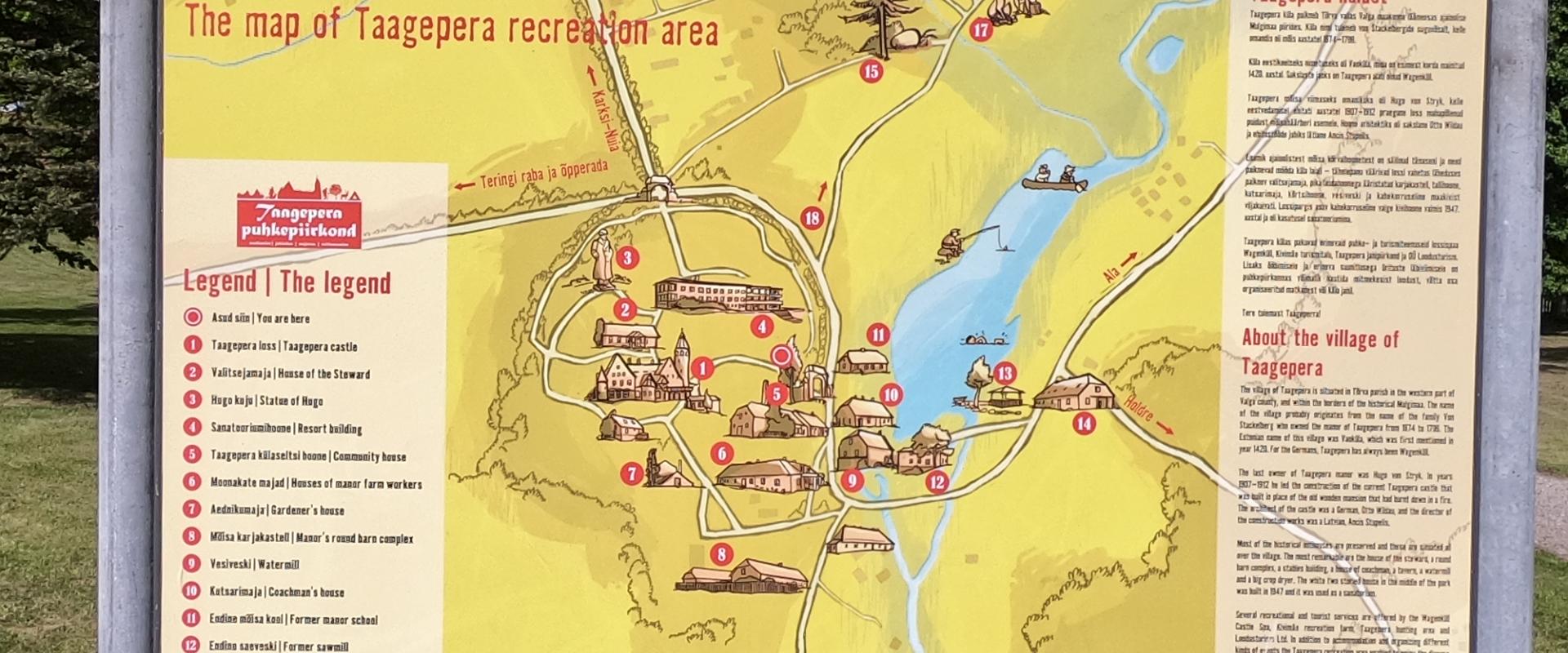
The total length of Taagepera hiking trail is 5.4 km. The trail begins and ends at the Taagepera campfire site and partly runs along the shores of the Õhne River. The trail can also be completed in smaller circles – 1.6 km and 4.0 km long. There are wooden signposts and information boards at the hiking trail, capfire site is suitable also for camping.The main sights of the hiking trail include the Taagepera Castle with the Castle Park, Taagepera Church and the Cemetery, the graveyard of barons, the Musukivi rock, the sacrificial stone, the underground cemetery, and the Õhne River.A truly inspiring hike full of history, architecture, and ancient nature!

Mugavused

  • Information boards
  • Drop Toilet
  • Free parking

Lahtiolekuajad

Aastaringselt

Ööpäevaringselt

Lingid

Vaata lisaks

  • Hiking Trails
  • Beaches

Lake Vaikne

Between the forests of Elva is a mysterious body of water – Lake Vaikne. The beautiful forest lake is a sight in itself and enchants visitors with its charming nature and silence at any time of the year. The lake has also won the attention of the poet J. Kärner, who at one time often came here to gather inspiration.The place is suitable for a responsible holidaymaker who prefers less populated places and wants to have a breath-taking experience. The lake is suitable for swimming – the water is clean and very warm.Use the wooden bridge to dive into the lake!Swimming is at your own risk!The area is illustrated by the wooden sculptures of the Nature Energy Trail.

  • Hiking Trails

Pikalombi nature trails

The trails have two possible starting points: in the parking lot of the Värska Sanatoorium or in the point on the side of Värska Sanatoorium across Värska Bay. The Pikalombi nature trails are 3.8 and 9.1 km long. The nature trails can be passed in autumn, spring and winter and on foot as well as by bicycle. On the boarded trail through the Velna bog the bicycle shall be pushed by hand. Good to know: There are 11 trail points along the trail. Point no. 6 lies by beautiful Lake Saarepää, offering an opportunity to make a fire and to have a longer break.

  • Lookout towers
  • Hiking Trails
  • Birdwatching

Valgesoo watchtower

The Valgesoo watchtower is located in the Valgesoo bog, which represents one of the 21 places worth discovering in South Estonia and is recommended for all nature enthusiasts.With its eye-catching design, the watchtower overlooks the Valgesoo bog, the pristine-looking primeval forest, and the Baron's pine forest (Parunimännik) and the study trail that runs through it. The 29.7 m high metal watchtower has three intermediate platforms, the last of which is 23.8 m high, with a wind screen and seat benches in the centre. The State Forest Management Centre's campfire site and camping area for up to five tents are nearby.

  • Hiking Trails

Lake Verijärv nature studies trail

Lake Verijärv nature studies trail is around 1 km long and has 9 information boards showcasing plants, trees, bushes, birds and animals. The trail runs through the Lake Verijärv ancient valley and wood. There are signs along the trail as well as three barbecue areas with benches.There are various legends about Lake Verijärv. It is said that the lake got its name centuries ago when slaves were punished in the old cellar that stood on the shore and their blood turned the water red. Another legend speaks of the nasty lord of Kasaritsa Manor, who was drowned by his coachman with his carriage and horses while driving home one night.

  • Family friendly
  • Hiking Trails
  • Beaches

Pühajärve Beach

During the summer season, beautiful Pühajärve Beach awaits you in Otepää with its clean sand, swimming pier, and full-sized outdoor swimming pool. In the summer, the beach has lifeguards, several catering companies, SUP board rentals, and boat rentals offering row boats, canoes, and pedal boats. A special pier and changing room have been built for visitors in wheelchairs. During the winter, a winter swimming pool is open on the beach. Pühajärve Park, which surrounds the beach, invites both young and old to walk along its shady paths. Come to Pühajärve and enjoy a day at the beach!

  • Camping sites
  • Hiking Trails
  • Beaches

Pikksaare hiking trail and Pangodi campfire site

The Pikksaare hiking trail begins at the swimming and camping area by Lake Pangodi. While walking along the hiking trail, you can enjoy peace and idyllic views of the lake and the surrounding nature and make a short detour to the War of Independence Memorial. The directional signs placed along the trail will help make the hike smoother. The hiking trail passes the Pangodi campfire site, where you can take a short break, as there is a shelter, a barbecue area, a nice swimming spot, and opportunities for camping. Come and spend a nice day in nature with your family or friends!

  • Lookout towers
  • Hiking Trails

Väike Munamägi Hill

Climbing to the top of Munamägi Hill is worth the effort – the view covers more than 50 km. The absolute height of Väike or Otepää Munamägi Hill is 207.5 m (relative height exceeds 80 m). There is a spring on the north-eastern slope of Väike Munamägi (in the direction of Otepää) that has been considered the start of the Väike Emajõgi River for a long time. The boulder on the edge of the first plain is the biggest in the area – 250,000 kg. Take a look at the aerial panorama (picture by Joel Tammet).

  • Hiking Trails

A nature study trail in the southernmost point of Estonia

Drive along the Võru-Valga highway from Saru to Kuutsi-Tiitsa-Karisöödi-Ura-Naha (about 14 km). The trail is about 4.8 km long and it takes a couple of hours to walk it through. The trail starts under the oak-tree with a perimeter of about 4 metres in Naha farm and runs very close to the state border, so make sure you take your ID with you. Interesting to know: you cannot put your foot down on the southernmost point, as the geographically correct southernmost point of Estonia is situated about 5 steps away from the marked spot, just in the middle of the Peetri River.

  • Privacy Policy

"*"обозначает обязательные поля

Это поле используется для проверочных целей, его следует оставить без изменений.
Я разрешаю маркетинг